 (source: nps.gov)
The Grand Canyon of the Yellowstone
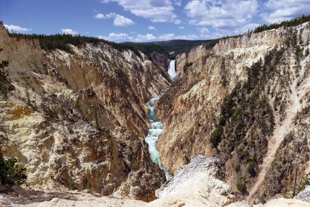
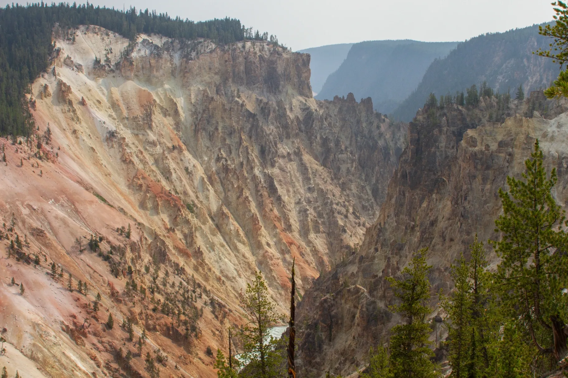
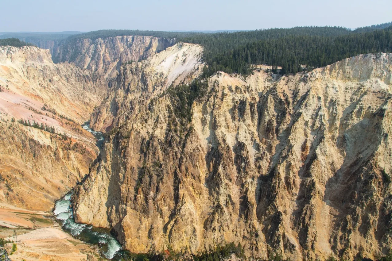
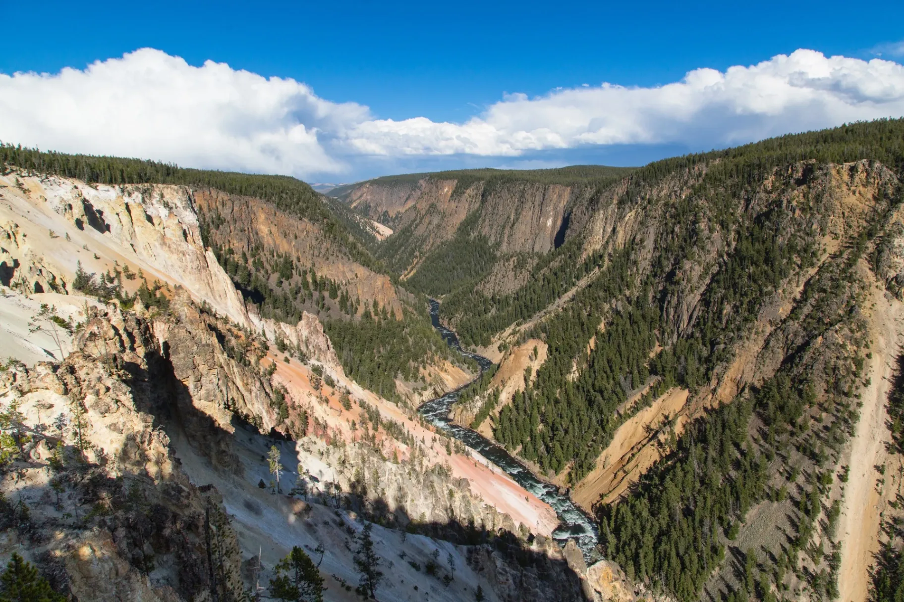
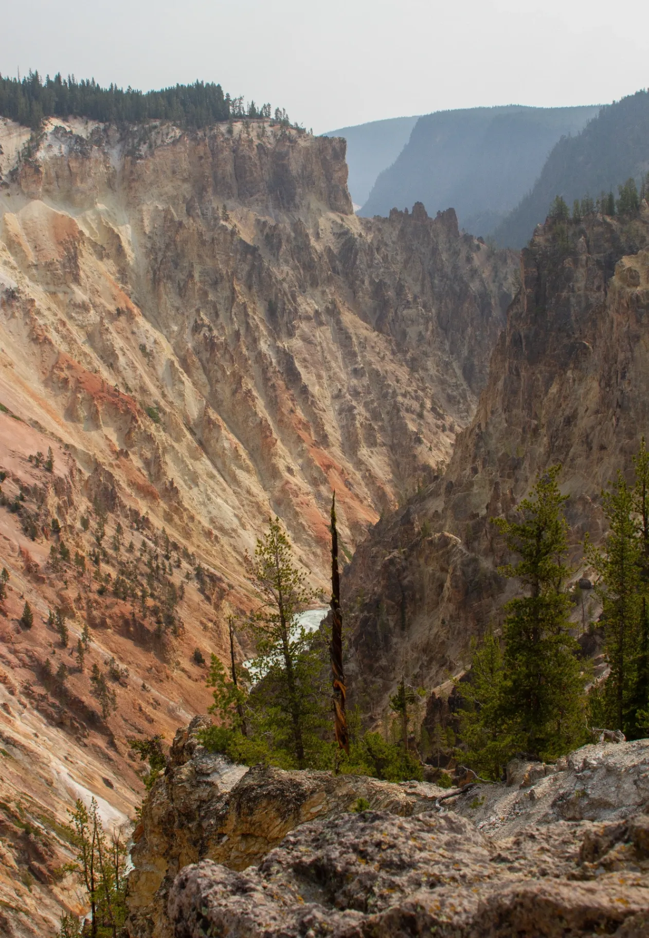
Old Faithful gets the headlines, but the Grand Canyon of the Yellowstone is the park's most jaw-dropping single landscape. The Yellowstone River has carved a 20-mile gorge up to 1,200 feet deep, framed by walls in shades of yellow, pink, gold, and cream — the result of hot water altering the rhyolite over millennia. Two enormous waterfalls anchor the upper end, and overlooks on both rims give you a different angle every few hundred yards.
This guide walks every major viewpoint on the South and North Rims, the trails worth the climb, seasonal logistics, and a half-day plan you can run from Lodgepole Pines Retreat in Island Park.
📍 Quick orientation
The canyon sits between Canyon Village (north) and Fishing Bridge (south). Two one-way scenic drives — South Rim Drive and North Rim Drive — link the major overlooks. Plan 3–5 hours minimum to do both rims justice.
Upper, Lower & Crystal Falls
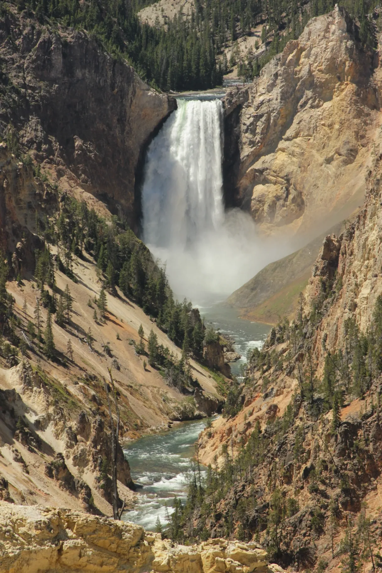
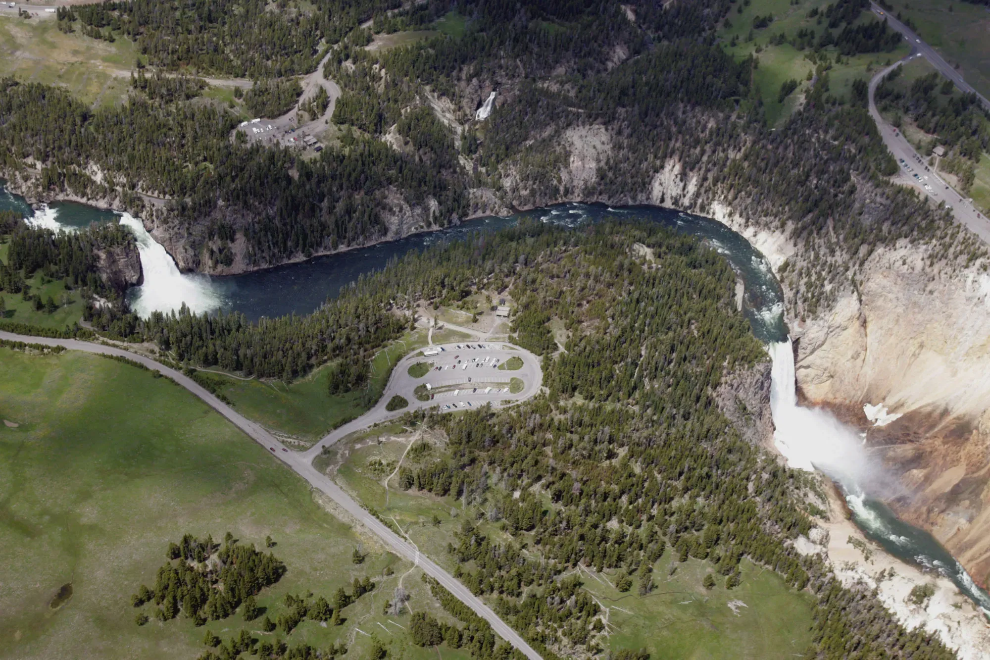
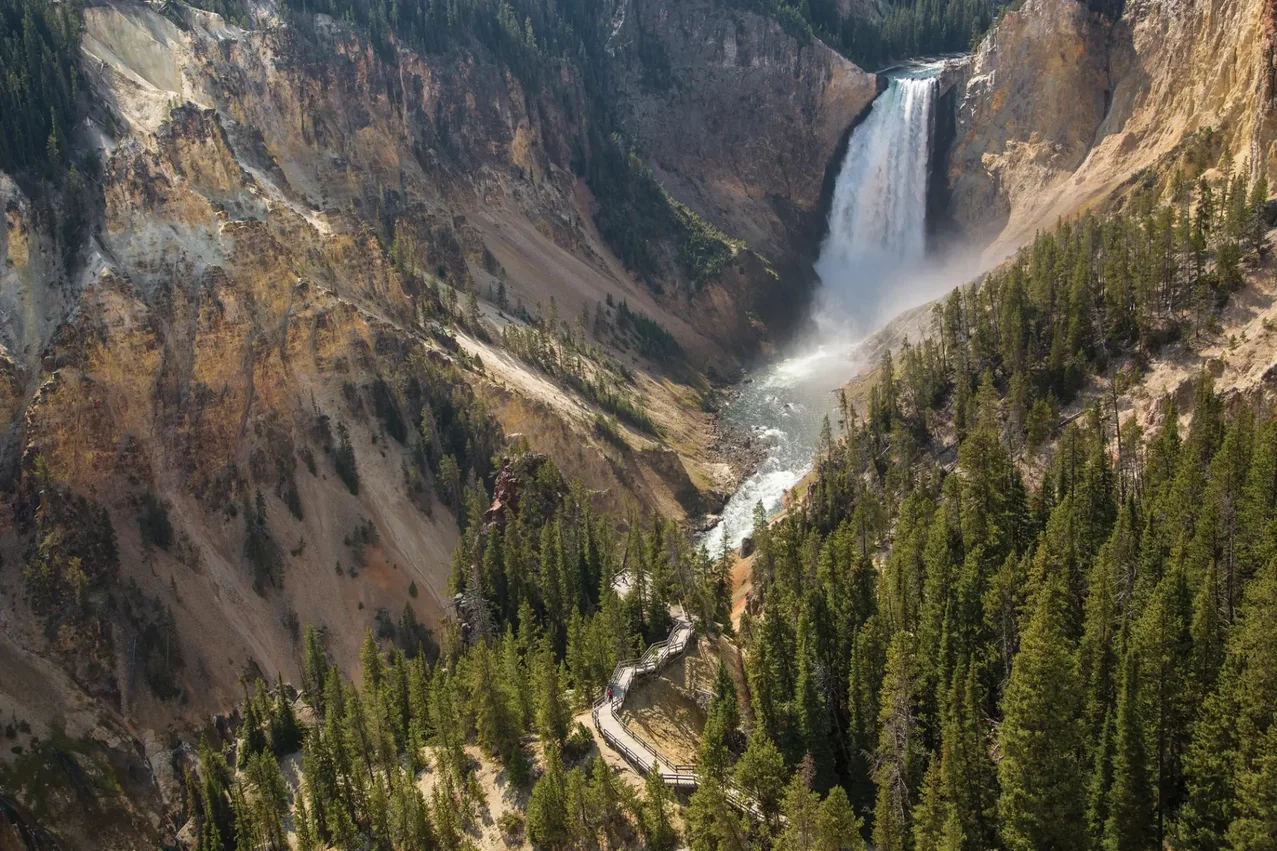
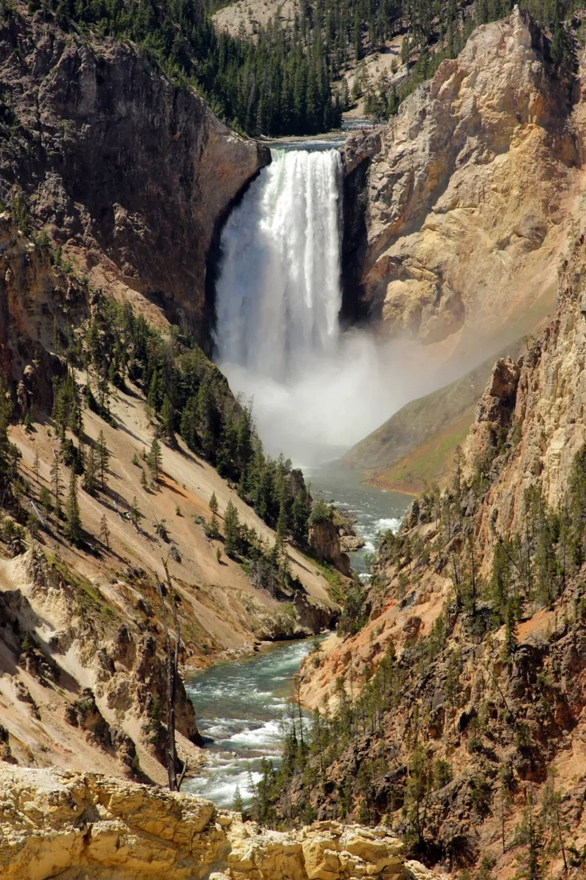
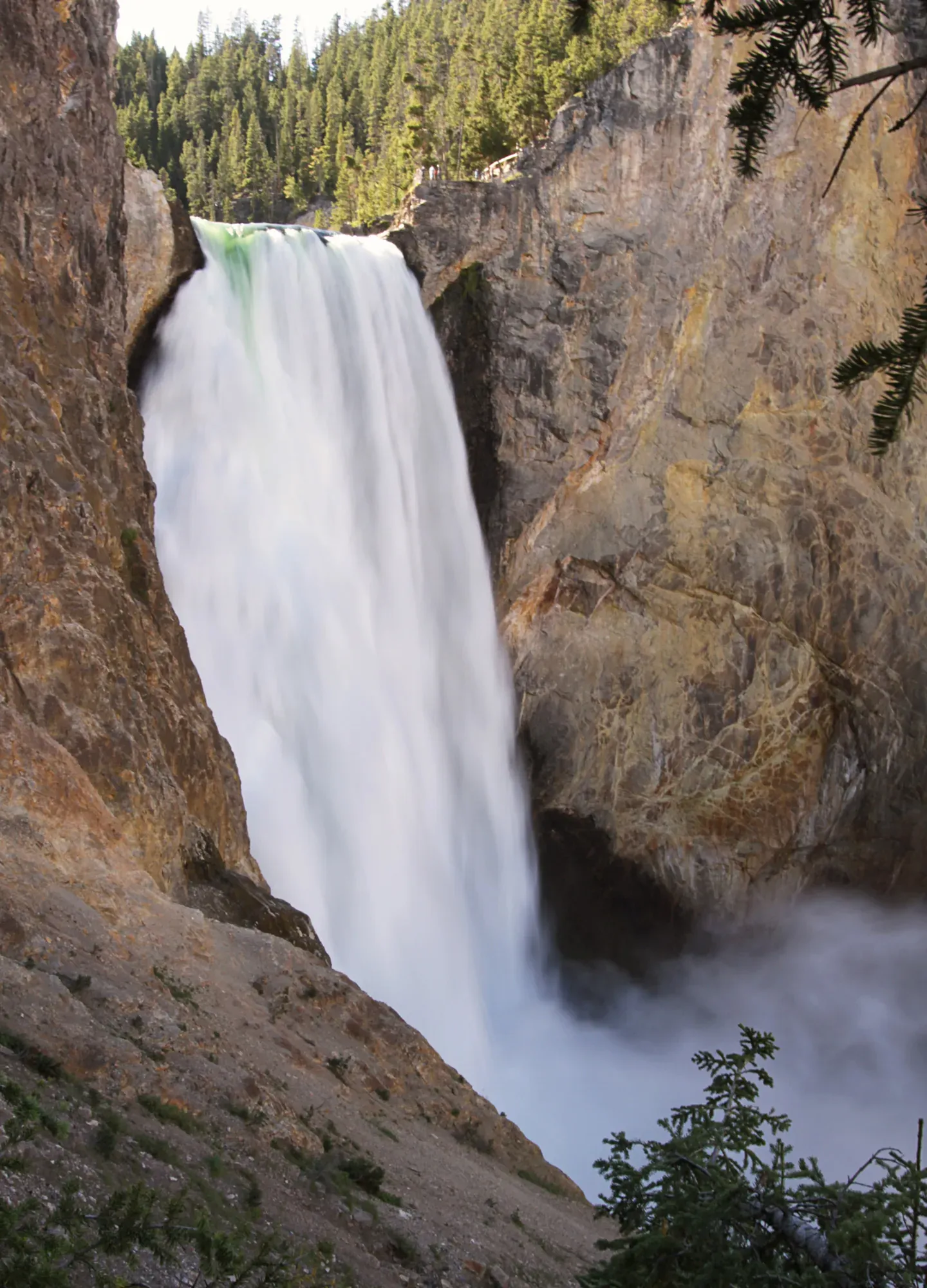
Lower Falls (308 ft)
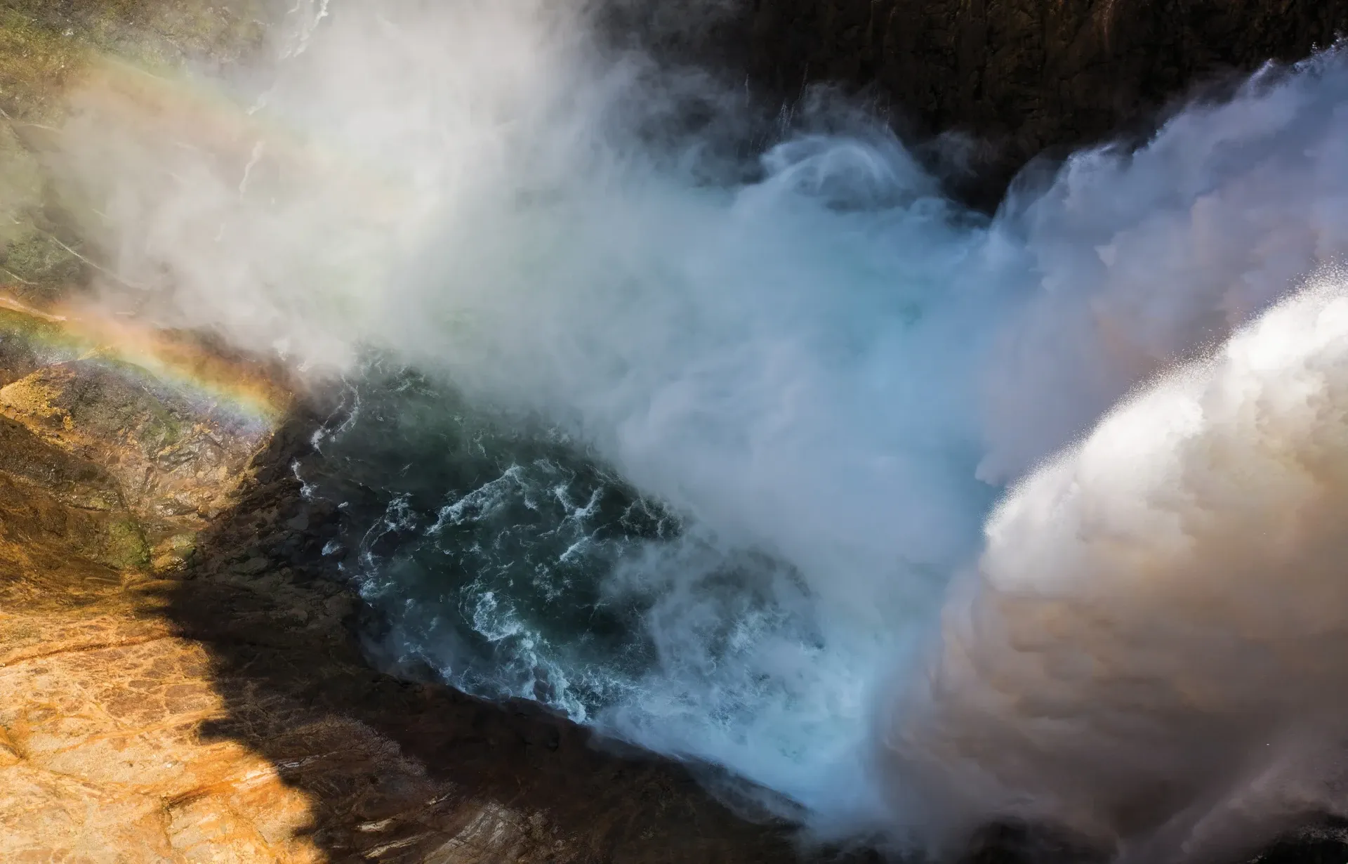
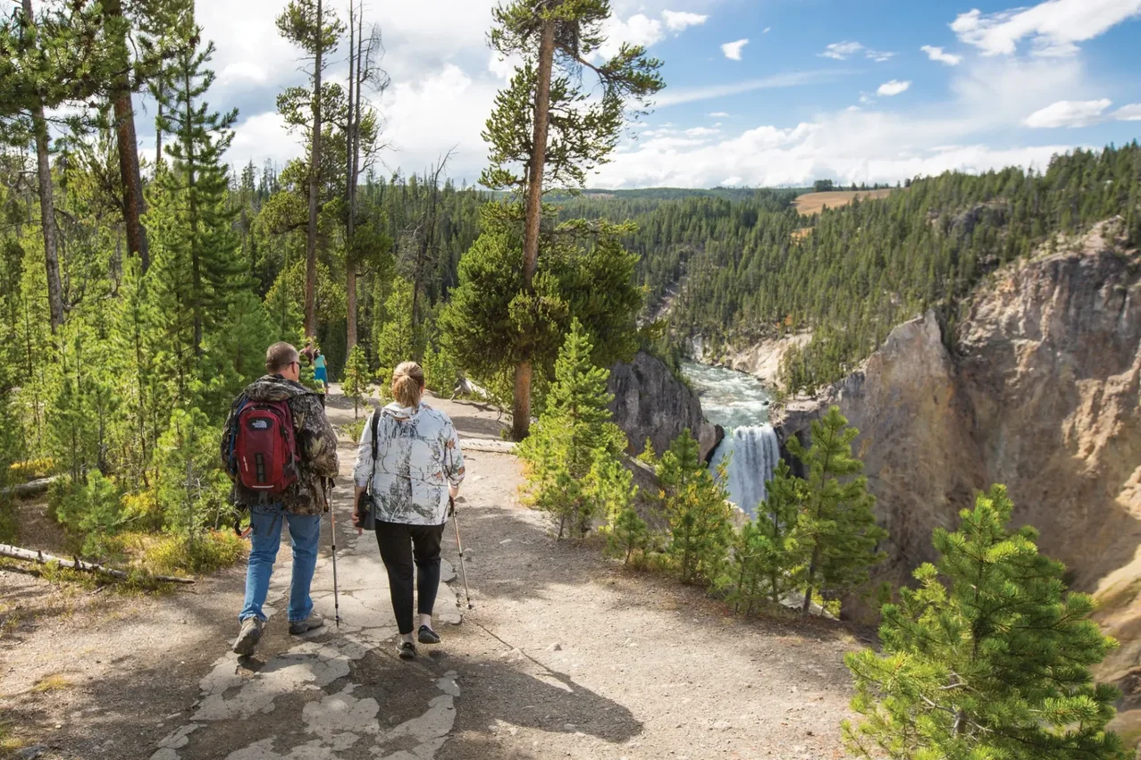
The headline act. The Lower Falls drop 308 feet — nearly twice the height of Niagara — into the heart of the canyon. From Artist Point you get the postcard angle; from Lookout Point and Red Rock Point you get the head-on view; and from the Brink of the Lower Falls Trail you can stand directly over the lip.
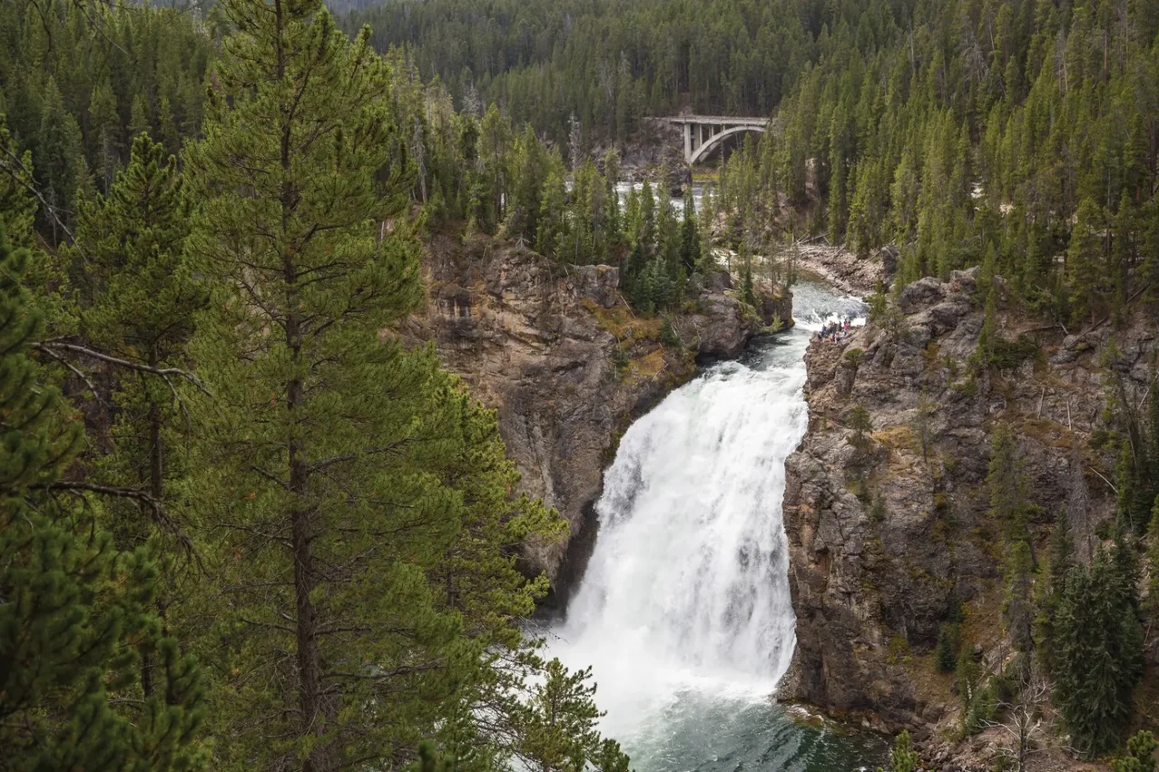
Upper Falls (109 ft)
Smaller but more compact and powerful-looking. Best viewed from the Brink of the Upper Falls overlook (a short paved walk) and from Uncle Tom's Point. The roar at the brink is unforgettable.
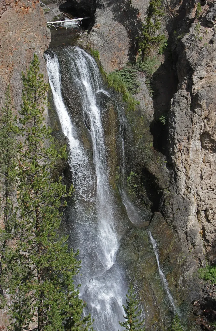
Crystal Falls (129 ft)
Tucked between the Upper and Lower Falls on Cascade Creek, Crystal Falls is the canyon's overlooked third act. The best view is from a small overlook on the South Rim Trail just east of Uncle Tom's parking.
South Rim Viewpoints
The South Rim Drive ends at Artist Point, the most photographed viewpoint in the park.
Artist Point
End of South Rim Drive
Best light: Sunrise & late afternoon
The classic Lower Falls postcard. Two railings — the upper one is the iconic frame.
Uncle Tom's Point
Mid South Rim Drive
Best light: Mid-morning
A short walk leads to a head-on Lower Falls view and the historic Uncle Tom's Trail.
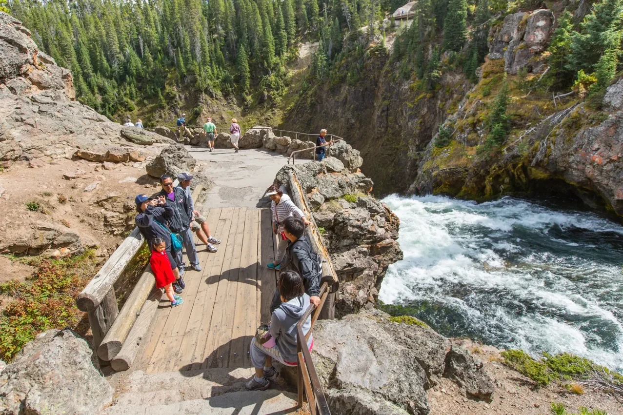
Brink of the Upper Falls
South Rim entrance
Best light: Anytime
A 100-yard paved walk drops you to a railing directly over the lip of the Upper Falls.
South Rim Trail
2.4 miles one-way
Best light: Morning
Connects Chittenden Bridge to Artist Point — multiple unmarked overlooks beat the parking-lot views.
North Rim Viewpoints
The North Rim Drive is a one-way loop with five overlooks. The South Rim is iconic; the North Rim is where you escape the Artist Point crowds.
Lookout Point
North Rim Drive
Best light: Morning rainbow over Lower Falls
Head-on view of the Lower Falls. Rainbow forms in the spray almost daily 9–11 a.m. in summer.
Red Rock Point
Short trail off Lookout Point
Best light: Mid-morning
A 0.4-mile descent gets you closer to the Lower Falls. Steep return.
Grand View
North Rim Drive
Best light: Late afternoon
The longest views down the canyon — afternoon light hits the colored walls best from here.
Inspiration Point
End of North Rim Drive
Best light: Afternoon
Deepest viewpoint into the canyon. Glacial Boulder is just down the access road.
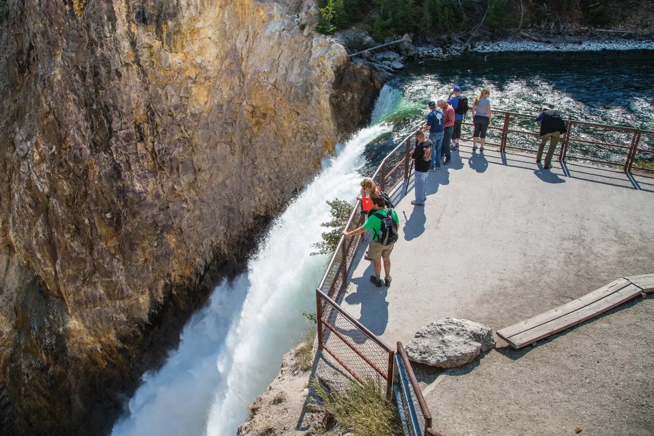
Brink of the Lower Falls
Steep 0.7-mile trail
Best light: Anytime
Switchbacks down 600 feet to a railing on the very lip of the Lower Falls. Tough climb back up.
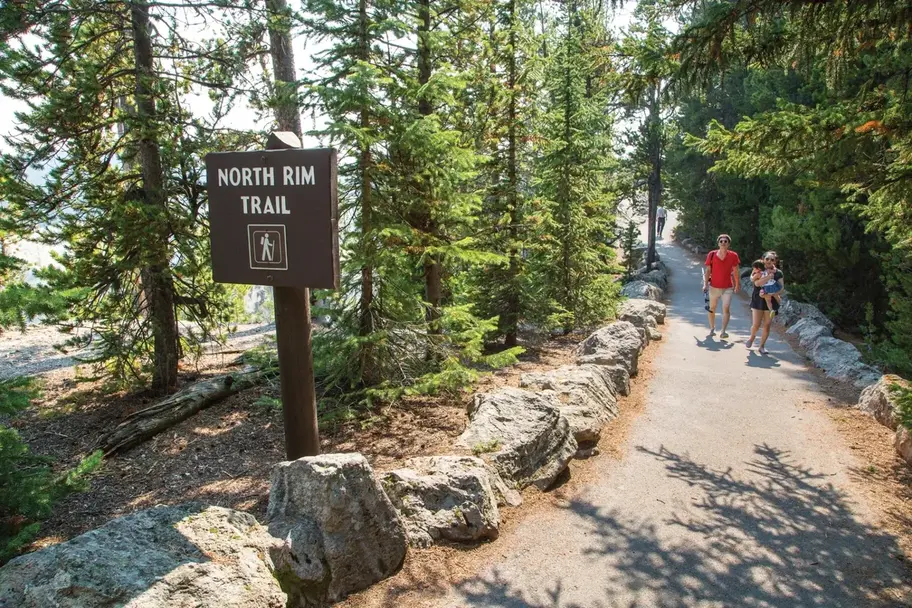
North Rim Trail
2.5 miles one-way
Best light: Morning
Strings together every North Rim overlook with quieter unofficial viewpoints between them.

Trails & Hikes
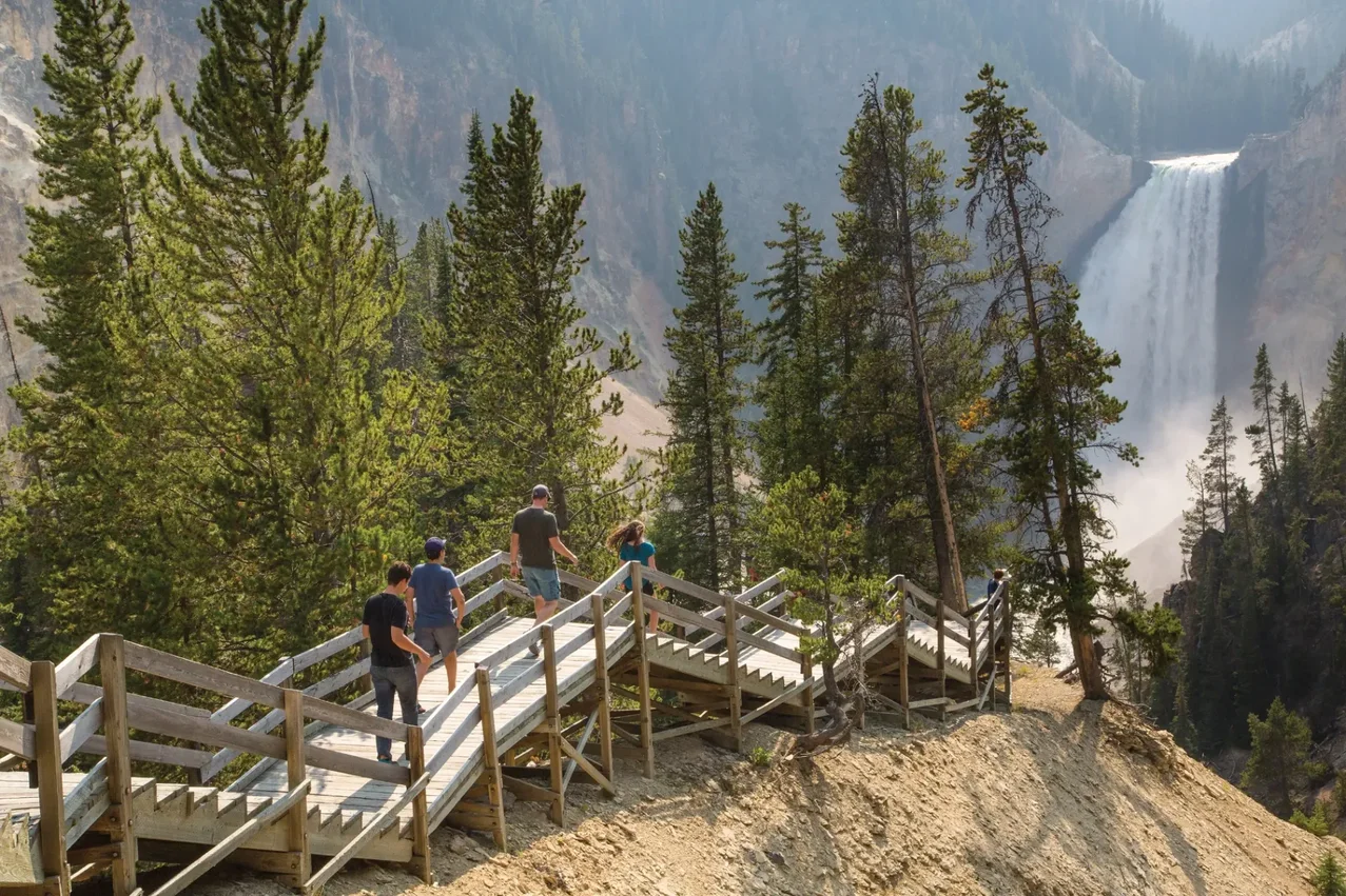
Brink of the Lower Falls Trail
Steep, paved switchbacks drop 600 feet in 0.7 miles to a railing directly above the lip of the Lower Falls. The view straight down the 308-foot drop is one of Yellowstone's most visceral experiences.
South Rim Trail (2.4 mi one-way)
From Chittenden Bridge to Artist Point. You'll pass Crystal Falls, Uncle Tom's Point, and a dozen unmarked viewpoints with zero crowds.
North Rim Trail (2.5 mi one-way)
Strings together Inspiration Point, Grand View, Lookout Point, Red Rock Point, and the Brink of the Lower Falls. Plan a car shuttle or backtrack.
Yellowstone River views
Below the Lower Falls, the river runs at the bottom of the canyon for 20 miles. The Lower Falls River viewpoint on South Rim Drive reveals the river snaking between the colored walls.
Seasonal Conditions
| Season | Access | What to Expect |
|---|---|---|
| Late Apr – May | South Rim opens late April; North Rim varies | Peak waterfall flow from snowmelt. Some trails closed for snow until late May. |
| June – August | All overlooks open | Peak crowds at Artist Point — arrive before 8 a.m. or after 6 p.m. |
| September – October | All overlooks open | Best season — fewer crowds, golden light, lower river flow shows more rock color. |
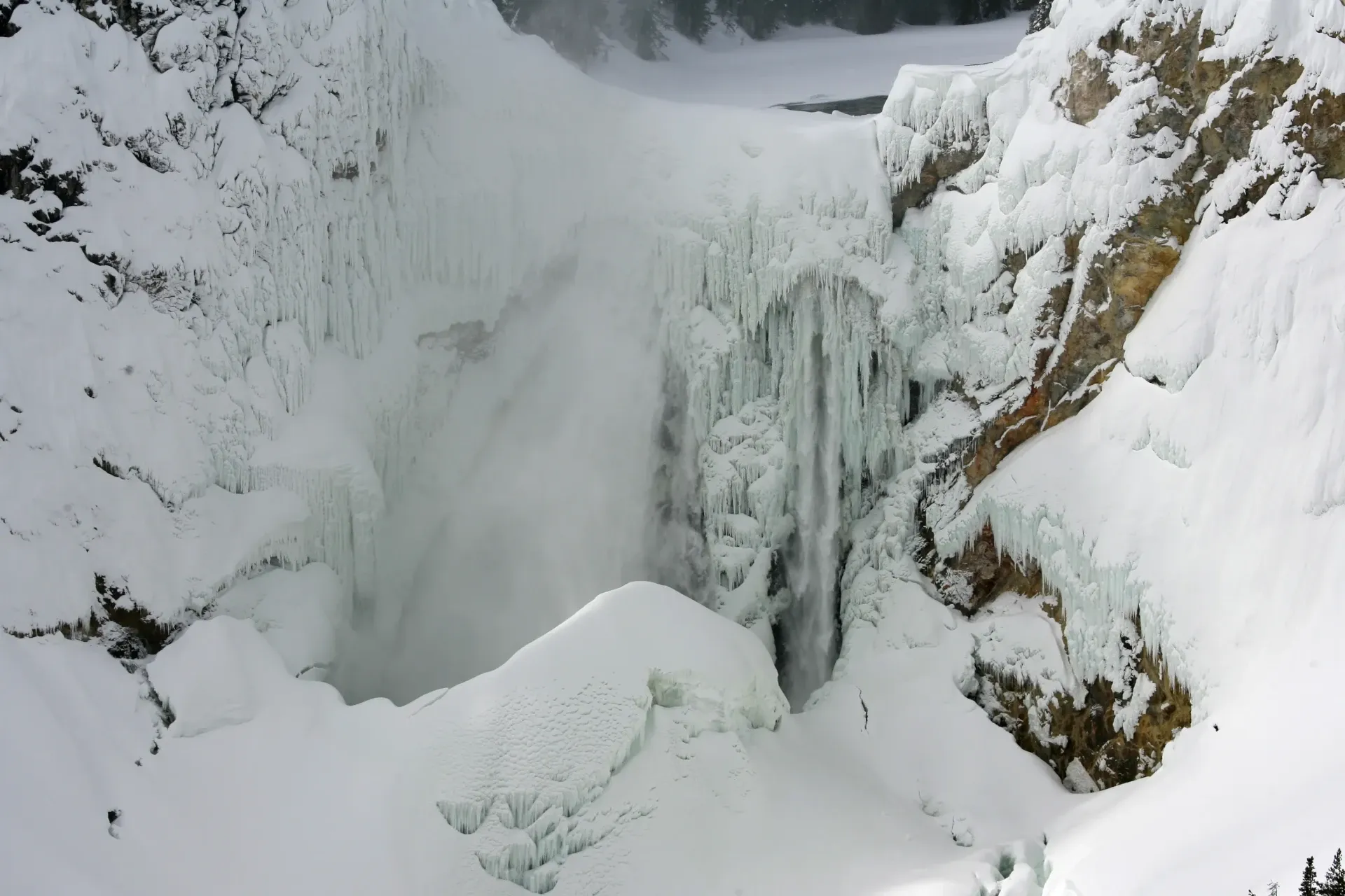
| November – April | Roads closed to cars | Access by snowcoach tour or ski-in only. Frozen Lower Falls is a stunning winter sight. |
Disclaimer: Road and trail openings vary year-to-year. Always confirm current status on nps.gov/yell before driving.
Photography Tips
- Artist Point: shoot at sunrise (canyon glows pink-gold) or late afternoon (Lower Falls fully lit). Avoid mid-day flat light.
- Lookout Point: between 9 and 11 a.m. in summer, a rainbow forms in the falls' spray almost daily.
- Use a polarizer to cut glare off the falls' mist and saturate the canyon walls.
- Bring a 24–70mm for the iconic frames and a 70–200mm for tight Lower Falls shots from the rims.
- For the Brink of the Lower Falls Trail, a wide 16–35mm captures the vertigo-inducing perspective.
- Tripod is allowed at all overlooks but most shots are handheld at standard apertures.

Half-Day Plan from Island Park
The canyon is about 2 hours from Island Park via the West Entrance, Madison, and Norris.
- 5:30 AM — Leave Island Park, enter West Entrance at 6:00 AM
- 6:00–7:30 AM — Drive Madison → Norris → Canyon Village (watch for bison along the Madison and Gibbon Rivers)
- 7:30–9:00 AM — South Rim Drive: Brink of Upper Falls → Uncle Tom's Point → Artist Point (best in early light)
- 9:00–10:30 AM — North Rim Drive: Brink of the Lower Falls Trail (steep but unmissable)
- 10:30–11:30 AM — Lookout Point and Grand View while the morning rainbow is still in the falls
- 11:30 AM — Lunch at Canyon Village
- 12:30 PM — Return via Norris and Madison; back at the cabin by 3 p.m.
🏠 Island Park is the best basecamp for the canyon
The West Entrance route to Canyon Village is roughly 2 hours each way — short enough that the canyon works as a day trip, far enough to escape the in-park lodging crowds. Check availability →
Frequently Asked Questions
Where is the Grand Canyon of the Yellowstone?
Central Yellowstone, between Canyon Village and Fishing Bridge. Roughly 24 miles long and up to 1,200 feet deep.
What is the best viewpoint?
Artist Point on the South Rim is the most iconic. Lookout Point and Red Rock Point on the North Rim are close seconds.
How tall are the Lower Falls?
308 feet — nearly twice the height of Niagara. Upper Falls are 109 feet; Crystal Falls is 129 feet.
Can you hike to the bottom of the canyon?
Not all the way. The Brink of the Lower Falls Trail and the historic Uncle Tom's Trail descend partway, but no maintained route reaches the canyon floor.
When is the canyon area open?
South Rim Drive typically opens in late April; the area is open through early November. In winter, access is by snowcoach or skis only.